
150 Years of History, 1876 to 2026

Maps, Then and Now

The maps from the Hutto 150 exhibit. Each one was redrawn from real sources; nothing on them is invented.

Tonkawa reservations and agencies, 1855 to 1885

Tap a marker to read about each stop.

Tonkawa homeland before 1855

The Tonkawa ranged across Central Texas, including the land that became Hutto.
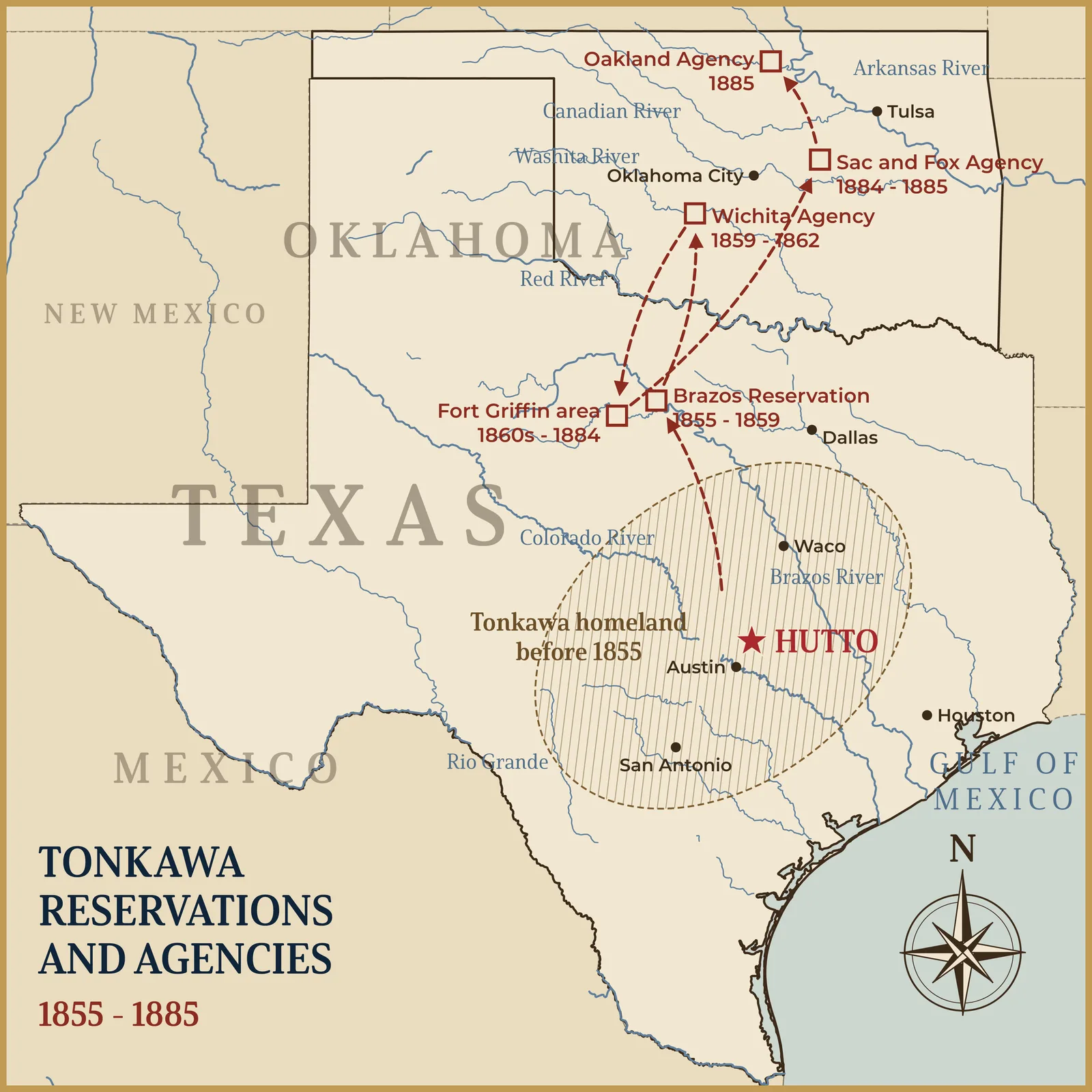
Tonkawa reservations and agencies, 1855 to 1885. Map redrawn for the Hutto 150 exhibit.

Tonkawa reservations and agencies, 1855 to 1885. Map redrawn for the Hutto 150 exhibit.

Hutto and its extraterritorial jurisdiction today. Map redrawn for the Hutto 150 exhibit.
Early Texas rail lines. Map redrawn for the Hutto 150 exhibit.
Original Hutto, the Southside. Map redrawn for the Hutto 150 exhibit.
The Railroad Addition, 1888. Map redrawn for the Hutto 150 exhibit.
Territory Acquired from Mexico. Justin H. Smith, The War with Mexico, 1919.